Run The Grand Canyon: South Rim
Run the Grand Canyon: South Rim via South Kaibab/Tonto/Bright Angel
-
Endurance/ Fitness Rating: 4
-
Technicality Rating: 2
-
Logistics Rating: 4
-
Scenery Rating: 5
(All ratings on a 5 point scale)
If you’ve run ultras or hang around ultra-runners, chances are you have encountered a few folks who have hammered out the notorious rim-to-rim-to-rim training run. I even have a few friends who’ve doubled that in a day just for fun.
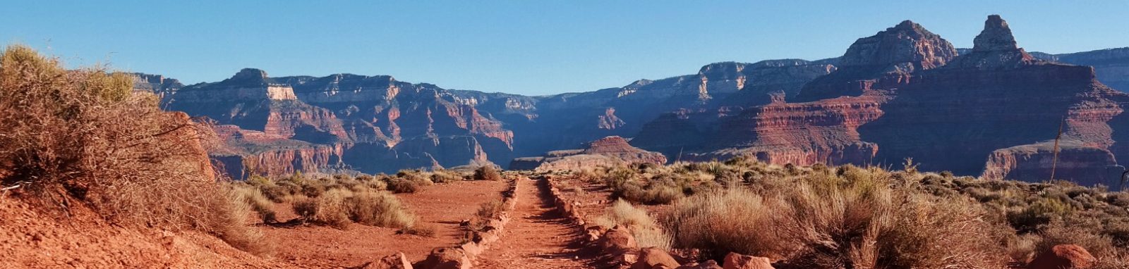
This particular run is nothing like that. The South Kaibab/ Tonto/ Bright Angel loops are excellent for Grand Canyon newbies (but not trail running newbies) who want their first trip to the South Rim to blow their mind with the epic scenery, without completely blowing up their legs.
This loop offers all of the landscape drama of the more popular Bright Angel Trail, with minimal crowds plus more backcountry solitude and ecological variety.
Trip Hacks
Before we talk routes, it’s really important to make note of a few things.
Time of Year: It matters. To get more of a “desert wilderness” experience, this loop is best done in “winter” (the air quotes are there to pay homage to the fact that winter in AZ is like a MN winter’s weaker, angsty pre-teen little brother). I strongly advise making your visit in late winter, mid-week, and avoid Spring Break times. The park gets about 5-6 million visitors per year, the bulk of whom visit Spring-Fall.
Crowd Avoidance: Run the Wilderness is centered around maximizing wilderness experiences, so I already avoid crowds on principle… But get this: I actually met someone on staff in in GCNP who told me how many deaths there really are in GCNP each year and that number isn’t small (the NPS stats only reflect deaths that fully occur IN the park, not those that occur in an ambulance that has already left the park or a hospital). I speculated the most common causes might be accidental falls, heart attacks, hyponatremia related complications, drownings, or lightning… but according to my source, one of the more common causes of death is actually suspected to be “assisted falls” i.e. murder-by-push, followed by jumpers. All the more reason to avoid people on the trail, particularly if you have crowd rage (ha).
Shuttle Time: One of the main advantages of South Kaibab versus Bright Angel is that it’s not accessible by vehicle which deters plenty of people; you have to park at the visitor center and take the shuttle to the trailhead. The first shuttle leaves around 6 or 6:30 AM. I always encourage taking the first possible shuttle if you want a solitary experience in one of the most dynamic places on earth as the sun rises. In order to do this, you’ll want to arrange accommodations pretty close to GCNP. If you followed my crowd avoidance hacks, you should also be able to get mid-week winter rates at cool places like Bright Angel Lodge.
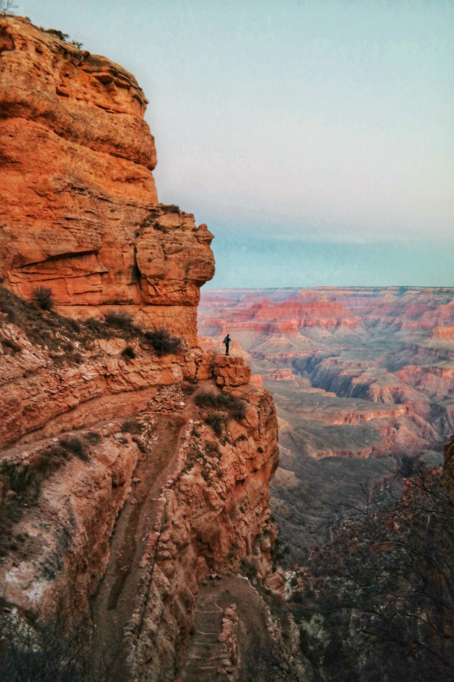
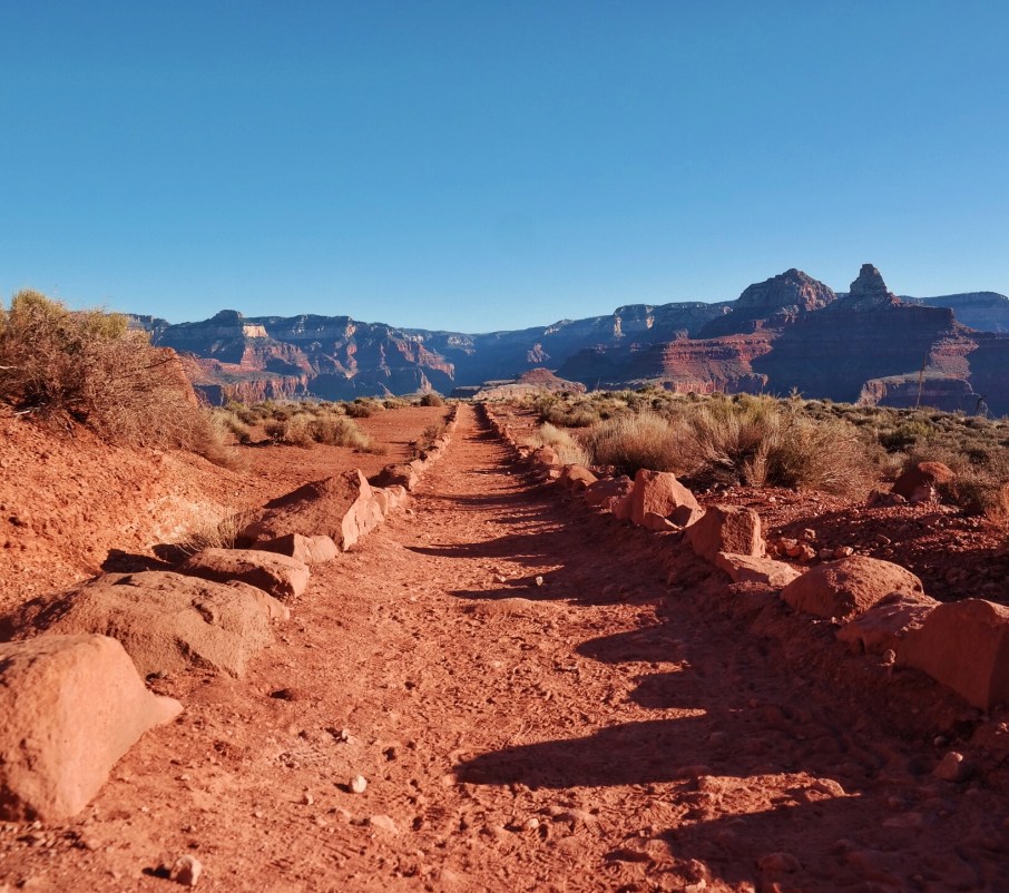
Trail Conditions: I did this loop in late February, and there was a decent amount of red-dirt camouflaged snowpack on the trails. One major advantage of taking South Kaibab on the descent into the canyon is that only the first ¼ to ½ mile is really treacherous in terms of ice as it’s shaded from mid-day sun only on that section. Bright Angel on the other hand, is more north facing and can be pretty icy for the first few miles of the descent and requires much more time staring at your feet or putting on crampons versus actually running and/or taking in the epic sunrise across the canyon. Regardless of your route choice though, crampons are an absolute must. I used Kahtoolas and they were perfect. When climbing out of the canyon via Bright Angel, I saw a few people who were reduced to crawling and completely terrified of the ice, as the noon sun had melted the surface and made it much more challenging than they’d experienced on the way down to Indian Gardens.
Weather: Let’s be honest, AZ winters are tropical by Northern standards, but the South Rim is at 7,260 feet altitude, which would be comparable to Estes Park CO, and that should be taken seriously. During winter and early spring months, snowstorms can happen suddenly and weather can be unpredictable and volatile. If you want visuals, here’s a video from a February 19-20 GCNP snowstorm a few years ago https://youtu.be/WlD5PI3e8sQ Pack accordingly and carry layers regardless of the forecast. Gloves, hat, baselayer, Patagonia Houdini/ lightweight shell, pants or tights, and of course sunscreen and/or sunshade gear are all great pieces for your kit. In other words, don’t be an amateur. Extra pack weight won’t kill you, but hypothermia might.
Water Stops: In the winter months, many of the normal GCNP water stops are shut off. During my February trip, the only places below the Rim where I could re-up on water were Phantom Ranch and Indian Gardens, so plan accordingly with larger bladders and spare bottles, and factor in the altitude. I’d recommend checking at the Ranger Station before your run to ensure both of these are in fact available or running depending on your trip dates.
Footwear: Trail running shoes, smartwool socks, Kahtoola spikes for icy sections, and gaiters to keep the red dust out of your shoes.
Maps: You won’t get a free trail map at GCNP; you have to buy trail maps or print your own ahead of time. They aren’t available for free when you enter the park, since 99.9% of park visitors never go below the rim save for a 0.1 mile hike to some petroglyths on Bright Angel. This is evidenced by everyone’s super clean shoes.
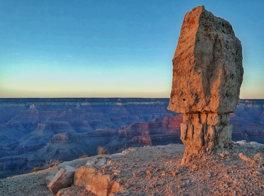
The Locals: The locals are your friends (game always recognizes game). If you have red dirt all over your trail shoes you will be easily identified as one of the 0.1% who visits a wonder of the world with the purpose of actually exploring the wilderness within it. Talk to the locals, (the rangers, the vendors, the biologists, etc.). They are excruciatingly bored with tourists and want to talk about the passions that brought them to work at a national park. Many of them are wilderness athletes. The locals were amazing on my trip to GCNP and gave great advice about a few places that aren’t on any maps, like Shoshone Point (arguably the best place on earth to watch a sunset, and it’s yet not open to the public in February).
Route Description(s):
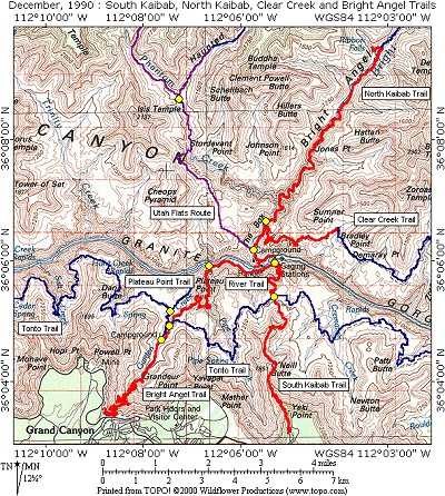
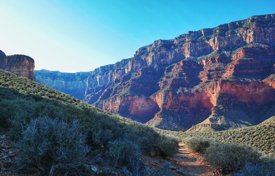
The South Kaibab trail begins with a series of tight switchbacks with gorgeous, expansive views of the canyon, first facing the red rocks to the north/northwest as early sun hits them. A bit later after rounding the red wall, the runner gets a whole new set of views of the greener canyon terrain to east, made even more dynamic by the full sunrise monty. After passing Skeleton Point the trail reaches the Tipoff (the first yellow dot on the Topo map) where there are pit toilets, 4.4 miles from the trailhead. We saw some horses and mules here, but there is no water stop.
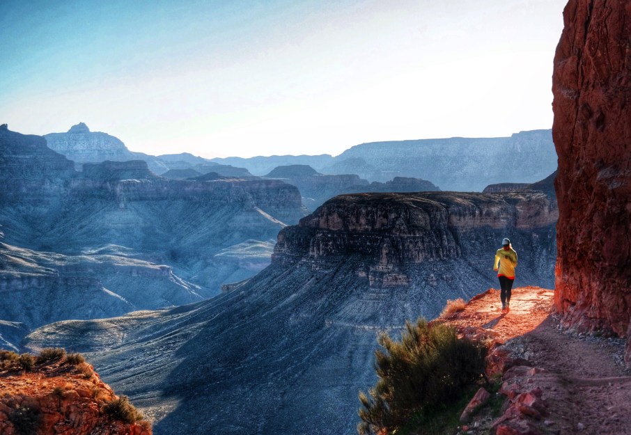
At this juncture, you can choose to turn west onto the Tonto Trail which hooks up with Bright Angel near Indian Gardens. This is the easiest loop and would take you back to your starting point in about 12 total loop miles. This entire loop is power hike-able in 4 hours, and obviously much faster if you run the descents and flats. The Tonto trail is rolling and runnable single track and has a unique charm as it traverses a fault line near the bottom of the canyon and passes a quaint babbling water source oasis, if you have a lifestraw, but note the Tonto Trail is still well above the Colorado River. South Kaibab offers views of the Colorado River on your descent and you can actually hear the water, but if you take Tonto versus continuing to Phantom Ranch Canteen, you won’t have bragging rights of having put your feet into the water, if that’s somehow important to you.
If you opt to visit the Colorado River or Phantom Ranch Canteen for a mid-run breakfast, then when you hit the Tipoff junction, continue another 2.6 miles down the South Kaibab trail instead of heading west on Tonto, then cross the Black Bridge, pass Bright Angel Campground, and it is about a fourth mile to the Phantom Ranch Canteen.
For the best return route, I recommend adding a few miles to your loop and backtracking on the South Kaibab to the Tonto Trail (near the Tipoff once more) and then head west to Bright Angel Trail versus taking the Bright Angel Trail straight from Phantom Ranch. Bright Angel is actually a somewhat boring (within GCNP scenery standards) and very crowded trail, and in my February experience it was filled with experienced and also confused people in jeans and snow-boots who looked thirsty and upset in the 80 degree heat.
Regardless if you choose Option A: to skip the Colorado River altogether and take Tonto straight away (12 total loop miles) or Option B: visit Phantom Ranch Canteen and loop back via the Bright Angel Trail (16.6 miles total loop) or Option C: leave Phantom Ranch via the scenic road less traveled back on S. Kaibab to TontoWest to Bright Angel (20ish miles total loop), all three will inevitably lead you to your return ascent to the rim on the Bright Angel Trail. The trail here is much less technical than South Kaibab, with lazy and relatively flat switchbacks for the first 2 miles, and slightly more of a challenge as you return to higher altitudes, with ever so slightly steeper switchbacks, and finally the fun addition of the ice and the Bright Angel crowds for the home stretch.
Remember, not everyone on Bright Angel is a crowd seeking adrenaline fueled tourist who accidentally out-walked his or her resources and morphed into an angry spouse pusher. For example, I met a couple hiking up from Indian Gardens to celebrate the wife’s 90th birthday, and they were going at a fast clip. All jokes aside, at the end of the day, anyone below the rim is at least attempting to have an adventure in the Wildest and Grandest of Canyons, unlike the 4,990,000 who step out of a vehicle only long enough to snap a photo from the Rim.
Happy Trails, friends! The wilderness awaits you.
Run the Wilderness: US National Parks Arizona Running Arizona Trail Running Backpacking Bright Angel Trail Fastpacking Grand Canyon Grand Canyon Winter Kahtoola National Parks Trials Patagonia Houdini Running National Parks Smartwool South Kaibab Trail South Rim Tonto West Trail Trail Running Ultra-Running Wilderness Running
